- Date:2017-2-8
Many people got lost on the huge campus and delayed their schedule at their first visit to NTU. In the mobile communication era, everyone has a smartphone. Open up google map with whether iPhone or Android, you will find that the department buildings of NTU are not sited on the map.
As a result, the「NTU Pass-PathFinder」APP is developed by the Computer and Information Networking Center to avoid guests from getting lost and solve the campus navigation problem. Here we show you the four design concepts we use while programming the APP:
- It can work without Internet connection, and use the Global Positioning System(GPS) to specify the guests’ position.
- Route planning as a pedestrian, and finding the shortest path.
- For environmentally friendly condition, and combining the use of YouBike, we expect the guests not to drive into the campus and make good use of the public transportation.
- For safety condition, emergency phones and AED positions are clearly specified in the APP.
The map shows the shortest path as picture 1 and shows the emergency phone and AED positions as picture 2.
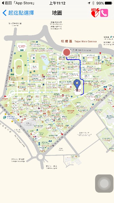
Picture 1: the map showing the shortest route.
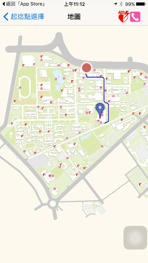
Picture 2: the map showing the emergency phone and AED positions.
